
Geography
Geography
The geography curriculum offer at our school follows the National Curriculum in Key Stage 1 and Key Stage 2, and the EYFS Statutory Framework and Development Matters in the early years.
Our Geography curriculum is highly ambitious and purposefully designed to give all learners, particularly the most disadvantaged and those with special educational needs (SEND), the foundational knowledge and cultural capital they need to succeed in life.
We believe in equitable endpoints; where required, adapted pedagogy and targeted PedTech (Pedagogical Technology) are employed to remove barriers to learning. This ensures that disadvantaged pupils and those with SEND are on the same geographical learning journey.
Our curriculum is carefully weighted, with equal priority given to both substantive knowledge (locational knowledge, place knowledge, human and physical geography, and geographical skills and fieldwork) and disciplinary knowledge (how geographers observe, investigate, interpret and explain the world around them). Clearly defined substantive knowledge end points are identified at the end of each unit, and disciplinary knowledge end points at the end of each key stage. Components (building blocks) are carefully sequenced so that new knowledge builds on what has been previously taught and leads to the end points.
The four key concepts - space, place, earth systems and environment - alongside the five organising concepts of time, scale, diversity, interconnection and interpretation, have been used to shape the geography curriculum to ensure breadth and depth. Key threads, such as ‘sustainability’, ‘climate’ and ‘settlement’, are intentionally threaded and repeated throughout the curriculum to help pupils make connections and deepen their geographical understanding.
In Early Years and Key Stage 1, plans are written following the end points and key concepts documents. This leads into the carefully adapted Pearson’s curriculum, which is taught in KS2. This is enhanced through additional mapping tasks to practise key geographical mapping skills, such as using grid references. These skills are further applied and developed through carefully planned fieldwork opportunities. Links are also made to prior concepts to help children know and remember more.
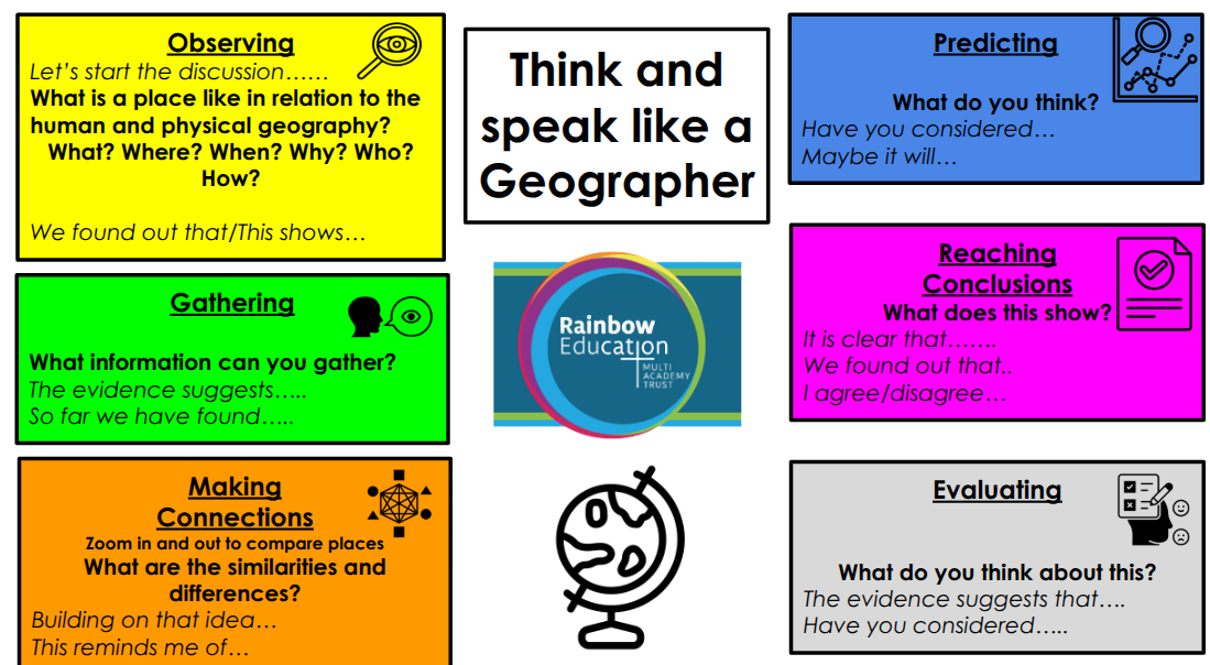
Please see above for our ‘Think and Speak Like a Geographer’ model, which is used to scaffold pupils as they observe and identify, gather and describe, make connections, predict, reach conclusions, and evaluate geographical information.
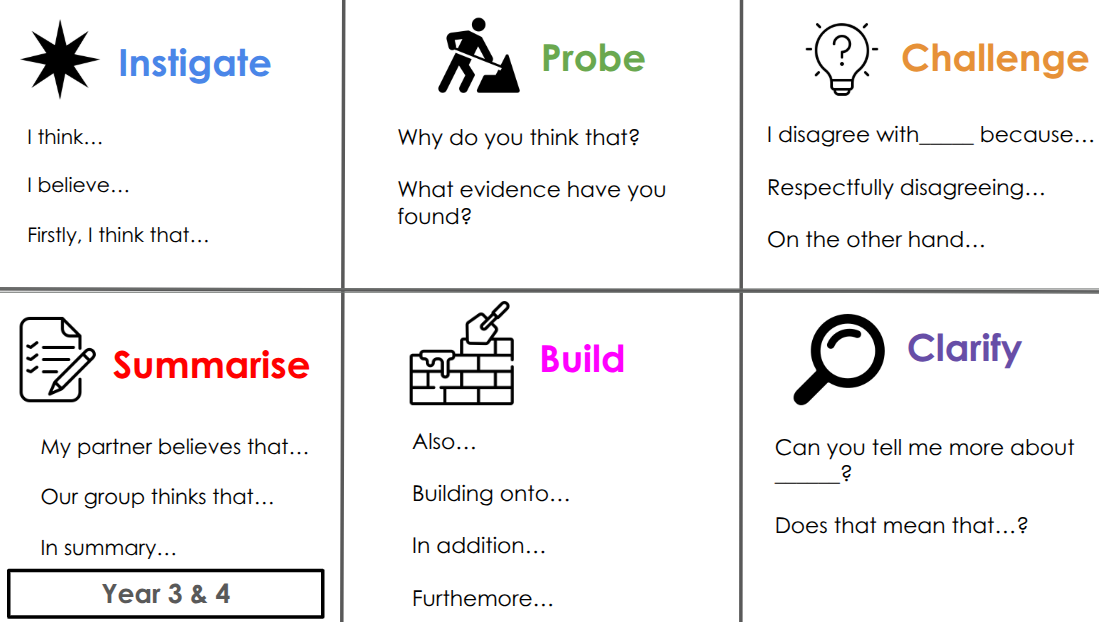
To develop confident communicators who can articulate geographical understanding, Talk Tactics are embedded throughout lessons. These structured, discussion-based opportunities encourage pupils to explain patterns, compare places, justify their thinking and use high-level tier 3 geographical vocabulary from the outset. Explicitly taught vocabulary is supported through actions and sentence starters, enabling pupils to transition from speaking like a geographer to writing like a geographer.
Review and retrieval are key parts of every lesson. Quick quizzes and knowledge organisers are used to support pupils in remembering and applying previously taught knowledge.
Our pupils represent an urban area of Wirral and this is reflected through an inclusive, diverse curriculum which is supported through additional extra-curricular focuses on events such as woodland learning and structured fieldwork opportunities.
For further information on our curriculum intent, implementation and impact, please see our curriculum page